- FOR THE EXPLORER: Plan your trip to the Redwood Forests, or find the spot of your favorite recreation areas nearby
- ACCURATE DATA: Road conditions and recreation potential are verified by field-checkers exploring the American West and beyond
- TRUSTED PUBLISHER: Our award-winning team of cartographers and editors work tirelessly to present the landscapes and data that travelers must have in order to maximize their experience
- HIGH QUALITY PRINT: Printed on polypropylene. The material is stronger than most papers and unlikely to crease or rip. The matte finish eliminates glare, and adds texture to the map. Ideal for display. Please note this map is NOT laminated - the page is not appropriate for dry-erase markers.
- ROLLED IN A STURDY TUBE: Your map is rolled and packaged in a sturdy tube to protect it during shipment
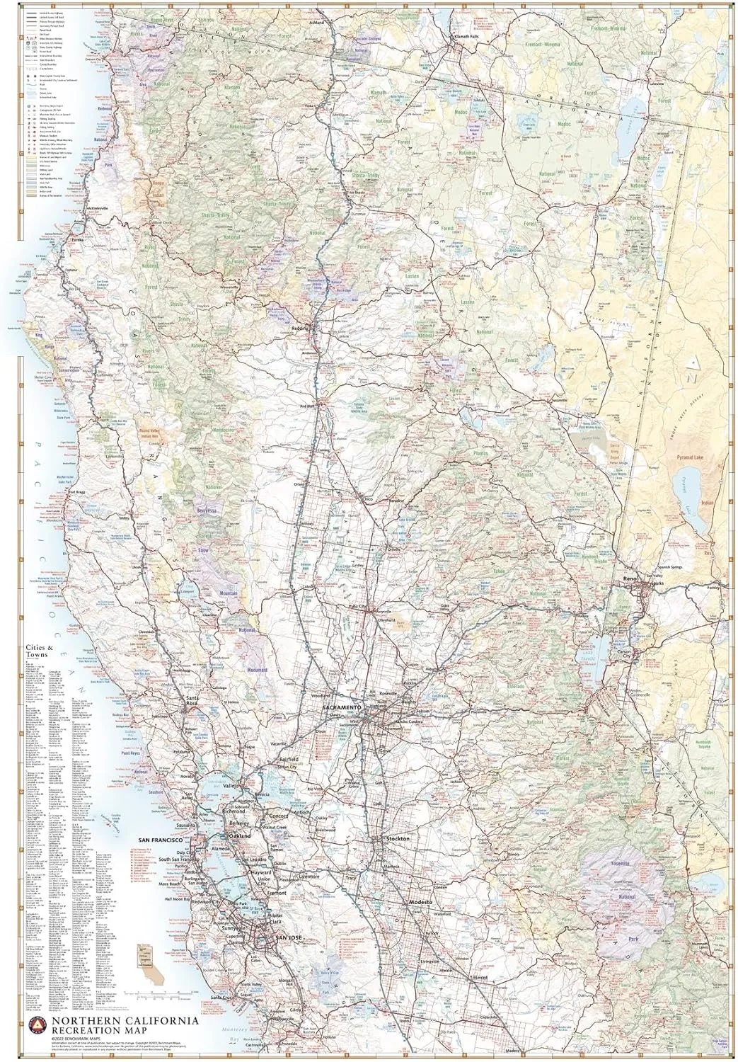
Northern California has an identity all its own, containing such iconic natural features as Redwood forests, Yosemite Valley, Lake Tahoe, San Francisco Bay and Mt. Shasta. From the Sierra Nevada Mountains to the Pacific Coast,
This wall map illustrates the northern half of The Golden State, highlighting its public lands and roadways that make them accessible to travelers of all interests.
Printed on polypropylene. The material is stronger than most papers and unlikely to crease or rip. The matte finish eliminates glare, and adds texture to the map. Ideal for display. Please note this map is NOT laminated - the page is not appropriate for dry-erase markers. Your map is rolled and packaged in a sturdy tube to protect it during shipment.


![[GLORS] Purly Handmade Medium Ballerina Press on Nails | Nude ombre Cat Eye Fake False Nails with Gold Floral Glitter | Salon Quality Ballerina Nail (M, MB)](https://www.makeupholic.shop/image/_glors_purly_handmade_medium_ballerina_press_on_nails__nude_ombre_cat_eye_fake_false_nails_with_gold_floral_glitter__salon_quality_ballerina_nail_m_mb__49mrrobt_285x.webp "[GLORS] Purly Handmade Medium Ballerina Press on Nails | Nude ombre Cat Eye Fake False Nails with Gold Floral Glitter | Salon Quality Ballerina Nail (M, MB)")


